Uluguru Mountains
The Uluguru Mountains constitute a mountain range in eastern Tanzania, named in honor of the Luguru tribe. The principal segment of the Uluguru Mountains is a ridge extending approximately north-south, ascending to an elevation of 2,630 meters (8,600 feet) at its apex. In the primary Uluguru range, 50 villages border the forest, and more than 151,000 individuals reside within the mountainous region, frequently at elevated densities at higher altitudes adjacent to the forest boundary.
The Ulugurus are situated 200 km inland from the Indian Ocean. They constitute a segment of the Eastern Arc Mountains in eastern Africa, encompassing the Taita Hills, Pare Mountains, Usambara Mountains, Nguru Mountains, Rubeho, Ukaguru, Udzungwa Mountains, and Mahenge Mountains. The mountainous forests serve as water catchment areas for streams and rivers. This water primarily originates from the forested summits of the Ulugurus, converging into streams that constitute the Ruvu River.
Biodiversity
The flora of the Uluguru main ridge and adjacent blocks is highly diverse. It encompasses arid lowland coastal forest habitats, transitional rainforests, as well as sub-montane, montane, and upper montane forest types.
The Ulugurus are home to more than 100 plant species, 2 avian species, 2 mammalian species, 4 reptilian species, and 6 amphibian species that are not found anywhere else globally. A significant number of additional species are exclusively shared with one or two other Eastern Arc mountains, rendering them globally rare. Endemic species encompass African violets, Impatiens, and Begonias, which are widely favored as potted plants globally.
Travel and tourism
The mountains draw numerous tourists to the region, especially owing to their proximity to the former capital and economic hub of Tanzania, Dar es Salaam, located 180 km away.
A visit to the “Morningside,” an ancient German hut at 1000 meters, constitutes a renowned short day hike, alongside excursions to Choma Waterfalls, Bondwe and Lupanga Peaks, a cultural tour of the Waluguru tribe, farmlands, and numerous additional attractions.
Geology
The Eastern Arc Mountains originated approximately 100 million years ago, stretching from the Taita Hills in southeastern Kenya to the Udzungwa Mountains in Tanzania.
The mountain peaks in the range are predominantly block-fault formations, having developed through cycles of uplift succeeded by extended phases of stability and erosion. The Uluguru Mountains and adjacent peaks of the Eastern Arc have historically been regarded as a conservation priority due to their substantial diversity of endemic species. The Uluguru Mountains predominantly consist of Precambrian igneous and metamorphic rocks, including granulite, gneiss, and migmatite. The soils in the region consist mainly of acidic lithosols and ferralitic red, yellow, and brown latosols. Certain regions of the range, such as the Lukwangule Plateau, are characterized by peat deposits.
History of Humanity
The Uluguru Mountains derive their name from the Luguru tribe, also referred to as the Ruguru or Waluguru. The Luguru are a Bantu-speaking ethnic group that has resided in the region for approximately 300 years. The Luguru tribe, unlike numerous tribes in Tanzania, is a matrilineal society where land claims are transmitted through female lineage.
Approximately fifty villages adjoin the forest reserve boundary surrounding the range, and at least 150,000 individuals reside in the mountainous region itself.
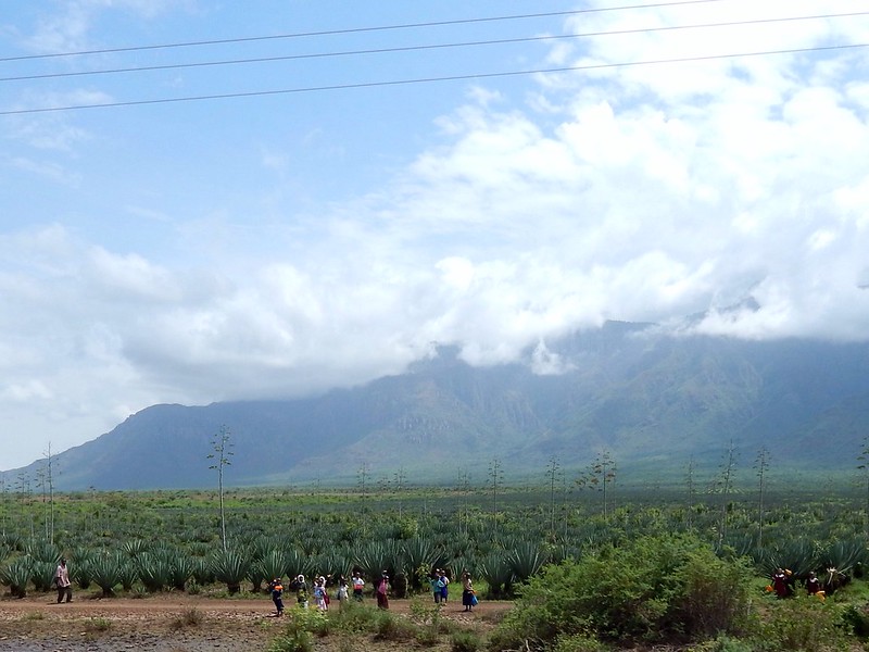
A significant number of local inhabitants engage in subsistence agriculture, while more intensive commercial agriculture is also conducted to cultivate crops such as rice, sorghum, maize, and cassava. Nevertheless, individuals generally refrain from raising cattle in the area due to the presence of tsetse flies, which can infect, debilitate, and lethally affect vertebrates such as cattle.
In the mid-1800s, an east-west caravan route traversed near the northern perimeter of the Uluguru Mountains. A man named Kisabengo established a village as a waystation for caravans to acquire provisions and porters. The town was originally named Simbamwene and subsequently evolved into the city of Morogoro, which persists to the present day.
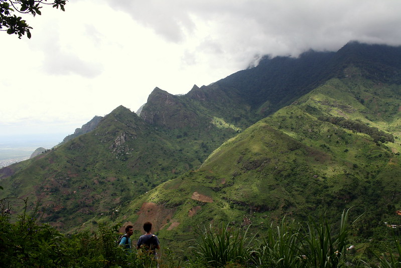
Best Treks in the Uluguru Mountains
The predominant hiking routes in the Uluguru Mountains for tourists residing in Morogoro include ascents to Bondwa Peak, Lupanga, Choma Waterfall, or various combinations thereof. Morningside serves as a frequently utilized hut, campsite, and vantage point for individuals extending their excursions into multi-day experiences.
An online resource offers a collection of maps detailing recorded footpaths for hikers in the steep mountains of the range; however, predominantly, there are no established trails within the range. Hikers typically traverse footpaths that have been utilized for years by local inhabitants as they navigate the region’s mountains.
A guide is necessary for trekking in the forests surrounding the Uluguru Mountains. Furthermore, due to the significant precipitation in the mountain range, all hikers in the area should be equipped with a rain jacket, regardless of whether it is the actual rainy season.
Although the Uluguru Mountains may not be the most renowned hiking destination in Tanzania, they offer several intriguing trails, including:
Bondwa Peak, at an elevation of 2,179 meters (7,119 feet), typically requires nine to ten hours for most individuals to ascend. The predominant expedition to the summit from Morogoro integrates a visit to Choma Waterfall with an ascent of Bondwa Peak. This journey typically necessitates an overnight accommodation at Morningside Hut.
The ascent of Lupanga Peak (2,146 m/7,041 ft) typically requires six to eight hours, rendering it a favored choice among local hikers.
The half-day trek to Choma Waterfall traverses local villages. It is an excellent choice for those seeking to deepen their understanding of the region’s culture.